BREAKING NEWS
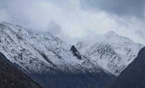
Srinagar, Jan 31: Jammu and Kashmir is likely to witness light rain and snowfall in the coming days, particularly in higher reaches, as a feeble Western Disturbance is set to affect the region, the Meteorological Department (MeT) said.
Kashmir experienced two notable spells of snowfall during Chilai Kalan—the Valley’s harshest 40-day winter period—which concluded on Friday.
According to a MeT official, weather conditions are expected to remain generally cloudy on Saturday, with the possibility of light rain or snowfall over some higher reaches towards the night.
The MeT has forecast widespread cloud cover on February 1, accompanied by light rain in lower areas and snowfall at higher altitudes. Thunderstorms and gusty winds are also likely at several places across the Union Territory.
A brief improvement in weather is expected on February 2; however, light rain or snowfall may occur at isolated higher reaches during nighttime. Cloudy conditions are likely to persist on February 3, with scattered to many areas experiencing light rain or snowfall in upper reaches.
“From February 4 to February 6, the weather is expected to remain partly cloudy, offering a temporary respite,” the MeT official said.
Another weak Western Disturbance may impact the region on February 7, bringing generally cloudy skies with light rain or snowfall at a few places. Dry weather conditions are predicted from February 8 to February 10.
Meanwhile, cold wave conditions continued across the Valley. The lowest minimum temperature was recorded at the ski resort of Gulmarg in north Kashmir, which settled at minus 6.5°C. Srinagar recorded a minimum temperature of minus 0.1°C.

© Copyright 2023 brighterkashmir.com All Rights Reserved. Quantum Technologies