BREAKING NEWS
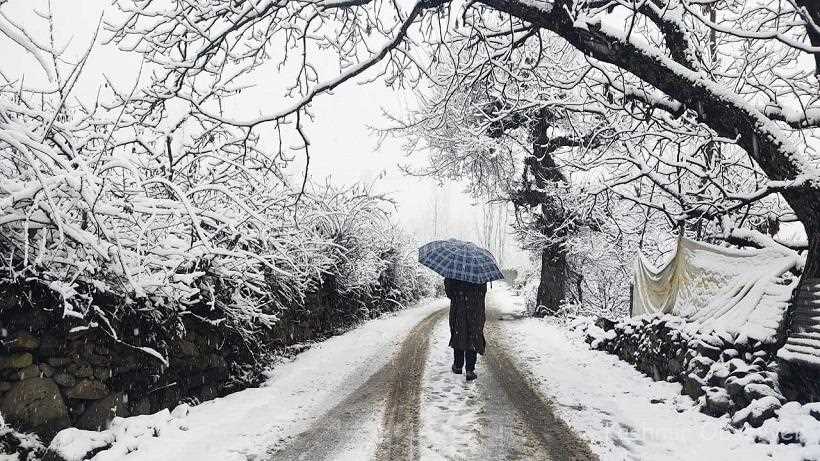
Fresh snowfall was reported in the higher reaches of Jammu and Kashmir while there was a cloud cover across the plains.
“Fresh snowfall was reported in the higher reaches including Zojila Pass, Minamarg, Baltal, and the Tulail Valley, bringing temporary relief from the prevailing cold wave conditions,” a MeT official said.
Snow accumulation ranged from 1 centimetre to about 3 inches, according to data compiled by independent weather channel Kashmir Weather.
Following the fresh snowfall in the upper reaches, minimum temperatures showed slight improvement in several areas, while plains remained under cloud cover.
Srinagar recorded a minimum temperature of 2.0°C, Qazigund 0.8°C, Pahalgam 2.4°C, Kupwara 1.2°C, Kokernag 0.8°C, Gulmarg 1.4°C, and Pampore 1.0°C. Srinagar Airport registered 0.6°C, while Awantipora recorded -0.2°C. Budgam stood at 1.2°C, Anantnag 0.8°C, Baramulla 1.4°C, Bandipora 1.3°C, Shopian 0.1°C, Kulgam 2.1°C, Ganderbal 1.0°C, and Sonamarg 0.4°C. Pulwama recorded the lowest minimum in the Valley at -2.7°C.
A MeT official said from December 14-15, the weather would be partly to generally cloudy with possibility of very light snow at isolated higher reaches of North & Central Kashmir towards late night/early morning hours.
“From December 16-18, there will be partly to generally cloudy. From December 19-20, the weather is likely to be partly to generally cloudy with possibility of very light snow at isolated higher reaches of North & Central Kashmir towards late night/early morning hours,” he said.
According to the MeT official, on December 21, the weather would be generally cloudy towards evening with possibility of light rain/snow at isolated to scattered places of Kashmir and isolated places of Jammu region.
“The shallow to moderate fog is likely to continue at many places of Kashmir and isolated places of Jammu region,” he said.

© Copyright 2023 brighterkashmir.com All Rights Reserved. Quantum Technologies