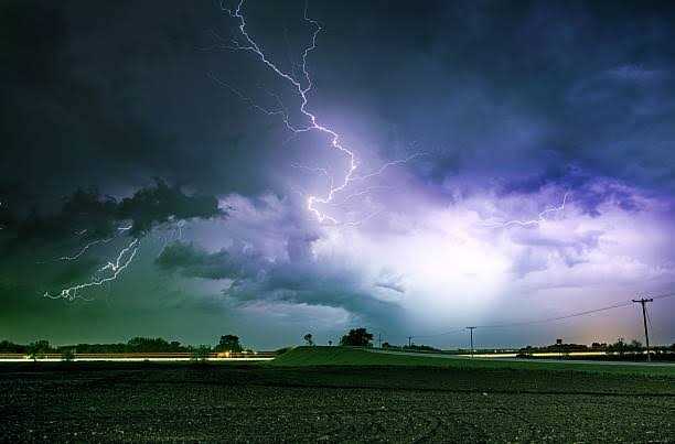
Srinagar, Sep 4: Jammu and Kashmir is likely to witness a fresh spell of thundershowers from tonight through tomorrow afternoon, with parts of the Union Territory expected to experience light rain and a noticeable dip in daytime temperatures.
The weather spell is likely to remain relatively brief but could bring a marked change in conditions, particularly across areas that receive showers. The activity is expected to make the daytime weather cooler, while mornings and evenings are also likely to feel noticeably colder in the coming days.
According to the forecast, light snowfall is possible over the extreme higher reaches of Jammu and Kashmir during the spell. The possibility of snowfall is particularly significant for the upper reaches, where temperatures are low enough to support wintry precipitation.
If the weather system persists around Gulmarg, light snowfall may also occur over Phase-II and the Affarwat hills during the morning hours. The higher reaches could therefore witness the first signs of a more pronounced transition towards cooler conditions at elevated altitudes.
The expected showers are also likely to bring down daytime temperatures across several parts of the Valley and adjoining areas. While the precipitation may be light in most locations, the associated cloud cover and cooler air could make weather conditions feel considerably different from the recent warmer spell.
Residents may experience cooler mornings and evenings over the next few days, particularly in areas located at higher elevations. Travellers and tourists heading towards Gulmarg and other upper reaches are likely to encounter colder conditions and should remain prepared for rapidly changing weather.
The anticipated spell also highlights the increasingly variable weather conditions being experienced across Jammu and Kashmir, where short-duration rain and thundershowers can produce sharp temperature fluctuations.
Authorities and commuters are advised to remain alert in vulnerable higher-altitude areas, particularly if the spell intensifies or persists beyond the forecast period.
For now, the main impact is expected to be a temporary drop in temperatures, cooler mornings and evenings, and light precipitation over parts of the region, with the possibility of snowfall confined mainly to the highest elevations.
The weather is expected to gradually improve after the spell, although the cooling trend could continue to make mornings and evenings noticeably chillier in the days ahead.

Srinagar, Sep 4: Jammu and Kashmir is likely to witness a fresh spell of thundershowers from tonight through tomorrow afternoon, with parts of the Union Territory expected to experience light rain and a noticeable dip in daytime temperatures.
The weather spell is likely to remain relatively brief but could bring a marked change in conditions, particularly across areas that receive showers. The activity is expected to make the daytime weather cooler, while mornings and evenings are also likely to feel noticeably colder in the coming days.
According to the forecast, light snowfall is possible over the extreme higher reaches of Jammu and Kashmir during the spell. The possibility of snowfall is particularly significant for the upper reaches, where temperatures are low enough to support wintry precipitation.
If the weather system persists around Gulmarg, light snowfall may also occur over Phase-II and the Affarwat hills during the morning hours. The higher reaches could therefore witness the first signs of a more pronounced transition towards cooler conditions at elevated altitudes.
The expected showers are also likely to bring down daytime temperatures across several parts of the Valley and adjoining areas. While the precipitation may be light in most locations, the associated cloud cover and cooler air could make weather conditions feel considerably different from the recent warmer spell.
Residents may experience cooler mornings and evenings over the next few days, particularly in areas located at higher elevations. Travellers and tourists heading towards Gulmarg and other upper reaches are likely to encounter colder conditions and should remain prepared for rapidly changing weather.
The anticipated spell also highlights the increasingly variable weather conditions being experienced across Jammu and Kashmir, where short-duration rain and thundershowers can produce sharp temperature fluctuations.
Authorities and commuters are advised to remain alert in vulnerable higher-altitude areas, particularly if the spell intensifies or persists beyond the forecast period.
For now, the main impact is expected to be a temporary drop in temperatures, cooler mornings and evenings, and light precipitation over parts of the region, with the possibility of snowfall confined mainly to the highest elevations.
The weather is expected to gradually improve after the spell, although the cooling trend could continue to make mornings and evenings noticeably chillier in the days ahead.
© Copyright 2023 brighterkashmir.com All Rights Reserved. Quantum Technologies