
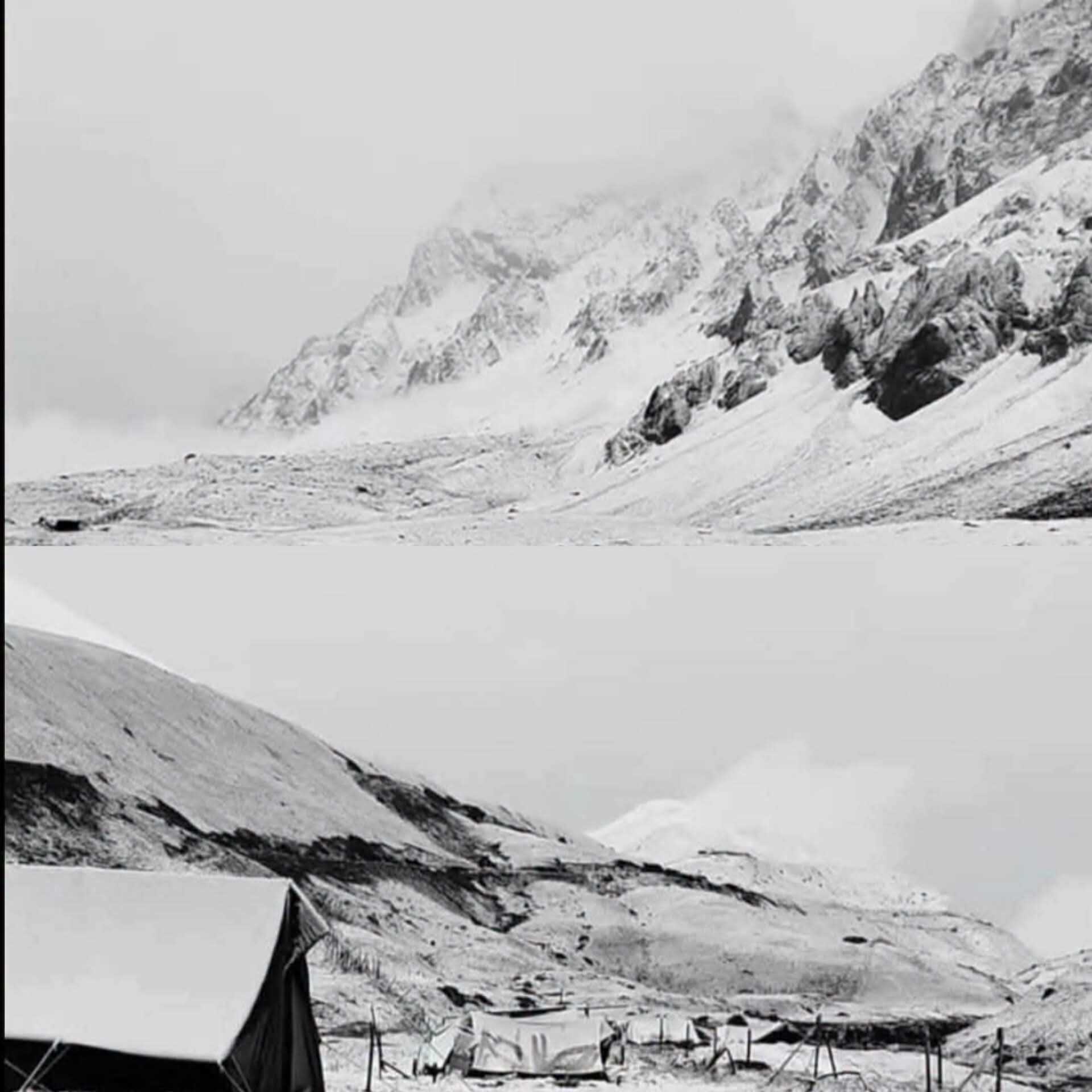
Srinagar, Sep 17: Fresh snowfall was reported from the higher reaches of north Kashmir’s Gurez Valley as rain and thunderstorms swept several parts of Kashmir during the intervening night of Wednesday and Thursday, bringing a drop in temperatures across the region.
Kabul Gali in the Tulail Valley of Gurez received a fresh layer of snow, covering the high-altitude landscape in white and bringing colder conditions to the mountainous areas.
The snowfall coincided with a spell of unsettled weather across Jammu and Kashmir, with several areas witnessing rainfall, lightning and thunder. The Meteorological Centre Srinagar had forecast rain and thundershowers between September 15 and 17, with the possibility of thunderstorms, lightning and gusty winds at isolated places.
Srinagar and other parts of the Valley experienced rainfall and thunder activity during the night, resulting in cooler weather conditions. The India Meteorological Department’s Srinagar station forecast generally cloudy skies with moderate rain for Thursday, with temperatures expected to range between 10 and 20 degrees Celsius.
The minimum temperature in Srinagar had dropped to 12.9 degrees Celsius on September 16, according to official weather records, marking the lowest minimum temperature recorded in the city during the month so far.
The fresh snowfall has further intensified the chill in Gurez, where temperatures in the higher elevations remain significantly lower than those in the plains. Snowfall at these altitudes often occurs earlier in the season as weather conditions begin to change.
The latest spell follows reports of the season’s first snowfall in parts of the higher reaches of Kashmir in early September, including areas of Tulail Valley, Kabul Gali and the Sonamarg-Zojila axis.
Located in the high-altitude Tulail sector, Kabul Gali is among the areas of Gurez that experience early snowfall. The fresh accumulation has given the surrounding mountains a wintry appearance, highlighting the changing weather pattern across the region.
The weather conditions have also prompted caution among residents and travellers using mountainous routes, where rainfall and snowfall can lead to sudden changes in visibility, road conditions and temperatures.
According to the latest forecast, weather conditions are expected to improve from September 18, with generally dry weather likely across Jammu and Kashmir until September 25. However, isolated brief spells of rain cannot be ruled out.
The latest weather spell has brought a fresh wave of cold to the upper reaches of Kashmir, while the plains continue to experience the effects of rain and falling temperatures.

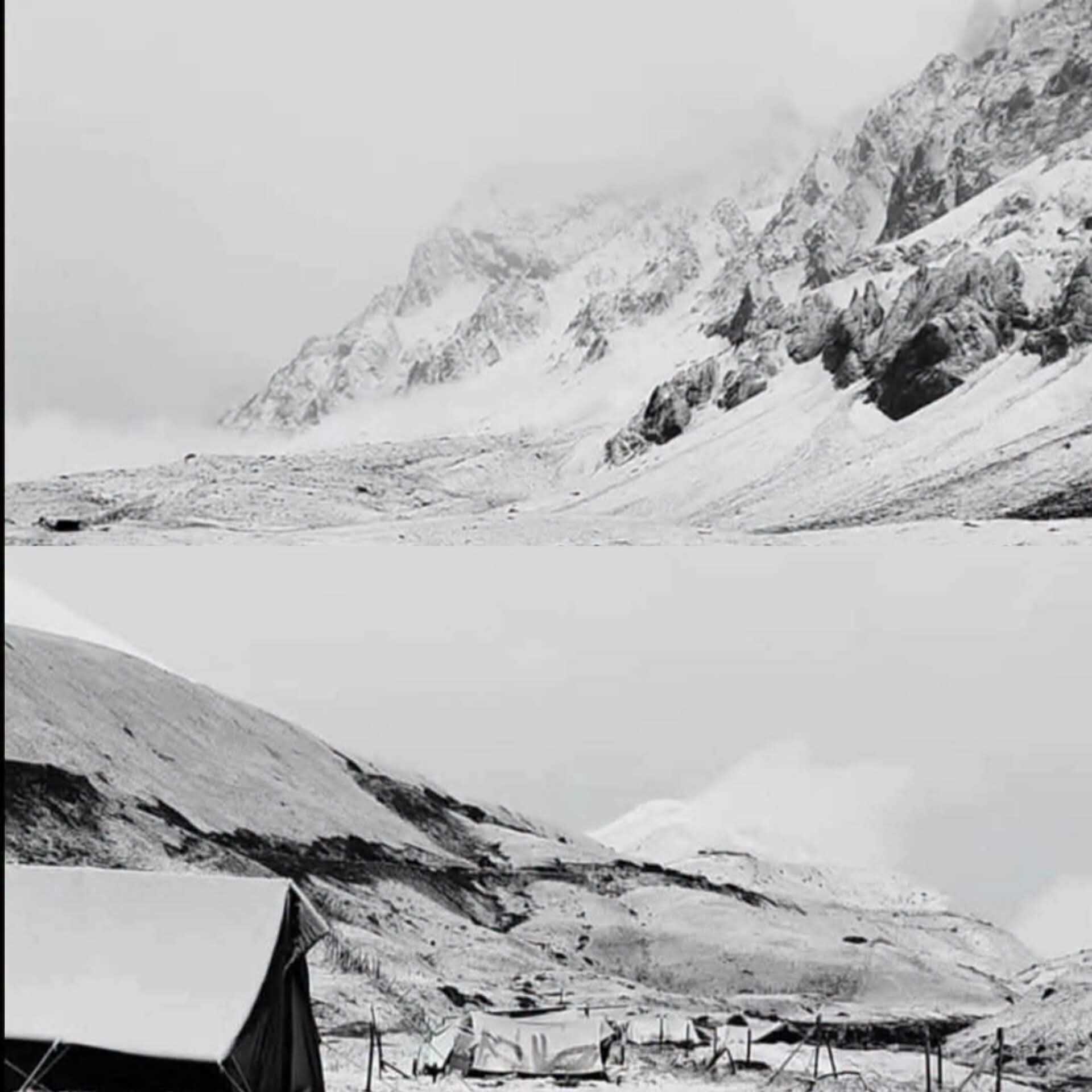
Srinagar, Sep 17: Fresh snowfall was reported from the higher reaches of north Kashmir’s Gurez Valley as rain and thunderstorms swept several parts of Kashmir during the intervening night of Wednesday and Thursday, bringing a drop in temperatures across the region.
Kabul Gali in the Tulail Valley of Gurez received a fresh layer of snow, covering the high-altitude landscape in white and bringing colder conditions to the mountainous areas.
The snowfall coincided with a spell of unsettled weather across Jammu and Kashmir, with several areas witnessing rainfall, lightning and thunder. The Meteorological Centre Srinagar had forecast rain and thundershowers between September 15 and 17, with the possibility of thunderstorms, lightning and gusty winds at isolated places.
Srinagar and other parts of the Valley experienced rainfall and thunder activity during the night, resulting in cooler weather conditions. The India Meteorological Department’s Srinagar station forecast generally cloudy skies with moderate rain for Thursday, with temperatures expected to range between 10 and 20 degrees Celsius.
The minimum temperature in Srinagar had dropped to 12.9 degrees Celsius on September 16, according to official weather records, marking the lowest minimum temperature recorded in the city during the month so far.
The fresh snowfall has further intensified the chill in Gurez, where temperatures in the higher elevations remain significantly lower than those in the plains. Snowfall at these altitudes often occurs earlier in the season as weather conditions begin to change.
The latest spell follows reports of the season’s first snowfall in parts of the higher reaches of Kashmir in early September, including areas of Tulail Valley, Kabul Gali and the Sonamarg-Zojila axis.
Located in the high-altitude Tulail sector, Kabul Gali is among the areas of Gurez that experience early snowfall. The fresh accumulation has given the surrounding mountains a wintry appearance, highlighting the changing weather pattern across the region.
The weather conditions have also prompted caution among residents and travellers using mountainous routes, where rainfall and snowfall can lead to sudden changes in visibility, road conditions and temperatures.
According to the latest forecast, weather conditions are expected to improve from September 18, with generally dry weather likely across Jammu and Kashmir until September 25. However, isolated brief spells of rain cannot be ruled out.
The latest weather spell has brought a fresh wave of cold to the upper reaches of Kashmir, while the plains continue to experience the effects of rain and falling temperatures.

© Copyright 2023 brighterkashmir.com All Rights Reserved. Quantum Technologies